Project Highlights:
- Over 60 miles of Quality Level C and D utility mapping data
- Ensured consistency, quality, and clear communication across all project stages, spanning more than five years
- Identified undocumented and abandoned infrastructure


DGT Associates is a leading provider of subsurface utility mapping, surveying, and geospatial services across the United States. With decades of experience and a strong focus on innovation, DGT combines advanced technologies with deep industry knowledge to deliver accurate, data-driven insights for infrastructure, utility, and construction projects. Their multidisciplinary team works closely with clients to uncover what lies beneath – safely, efficiently, and with confidence.
Eversource, New England’s leading energy provider, hired DGT Associates to map the most feasible route to connect new and existing substations in Boston, Massachusetts. The goal was to find the optimum routes for construction while minimizing disruption, minimizing the risk of utility conflicts, and protecting existing infrastructure. Building a robust electrical grid has never been more important.

Project Spotlight: Providing Subsurface Utility Mapping to Improve Boston’s Electric Grid Allston, Massachusetts, has been drawing people into its quaint neighborhood since the 1630s, accelerating since its 1874 annexation into the City of Boston. What was once a community of early English settlers has since become home to college students and families spanning all walks of life and, in more recent years, housing the expanded Harvard University science and engineering campus. With a growing population of 29,000 people and counting, there’s an increasing demand in Allston to expand the city’s access to the electric grids of Boston, Somerville, and Cambridge. To combat the growing energy needs, Eversource, New England’s leading energy provider, hired DGT Associates to map the most feasible route to connect new and existing substations. The goal was to find the optimum routes for construction while minimizing disruption, minimizing the risk of utility conflicts, and protecting existing infrastructure. Building a robust electrical grid has never been more important.

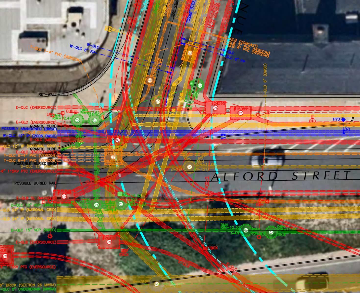
Before any official construction proposals could be drafted and presented to Eversource’s project team, they needed a thorough understanding of the underground utilities surrounding the potential transmission routes. Initially, DGT was brought on by Eversource to provide over 60 miles worth of CI/ASCE 38-22 Quality Level C and D surveying data. Subsurface Utility Mapping (SUM) at the Quality C and D levels is considered low stakes as it relies on existing records for information and only surveys above-ground utilities. This level of survey data provided Eversource with a general understanding of utility congestion along the potential subway routes and a more complete picture of which underground stakeholders would be involved before investing in higher levels of subsurface investigations using remote sensing technologies. With any large-scale project, project owners often utilize multiple consultants to allow for various perspectives and expediency. However, having more cooks in the kitchen doesn’t always result in better outcomes. Project owners that utilize multiple providers, especially for one specialty, can end up with inconsistency in the quality of work and the processes in place by each consultant. To streamline data gathering, work product consistency, and client communication, Eversource hired DGT as the sole provider of underground utility mapping for the entire project. As with all DGT projects, we remained committed to sharing project deliverables every Friday. DGT prides itself on being reliable and consistent from the start of the project to the end of the project. This consistency was important as the design and planning would span over five years.
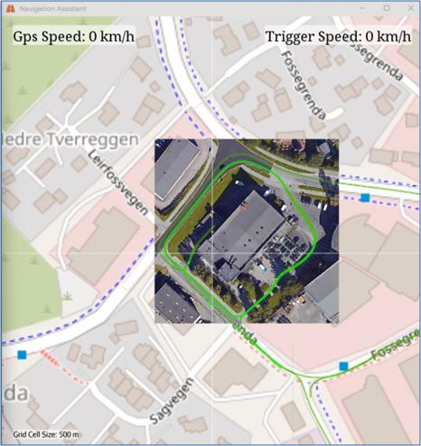
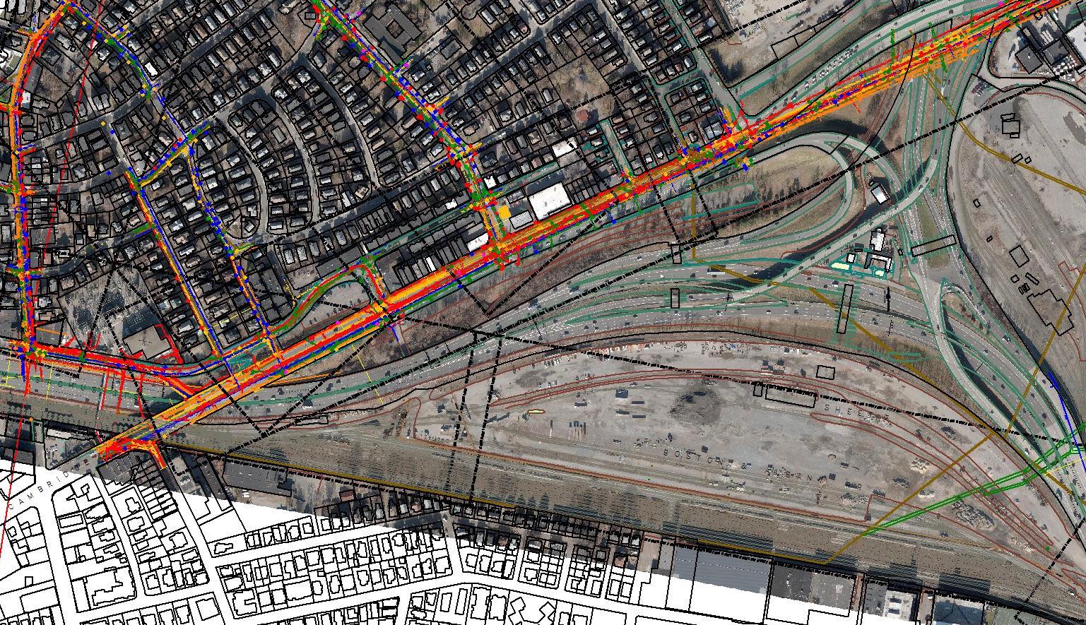
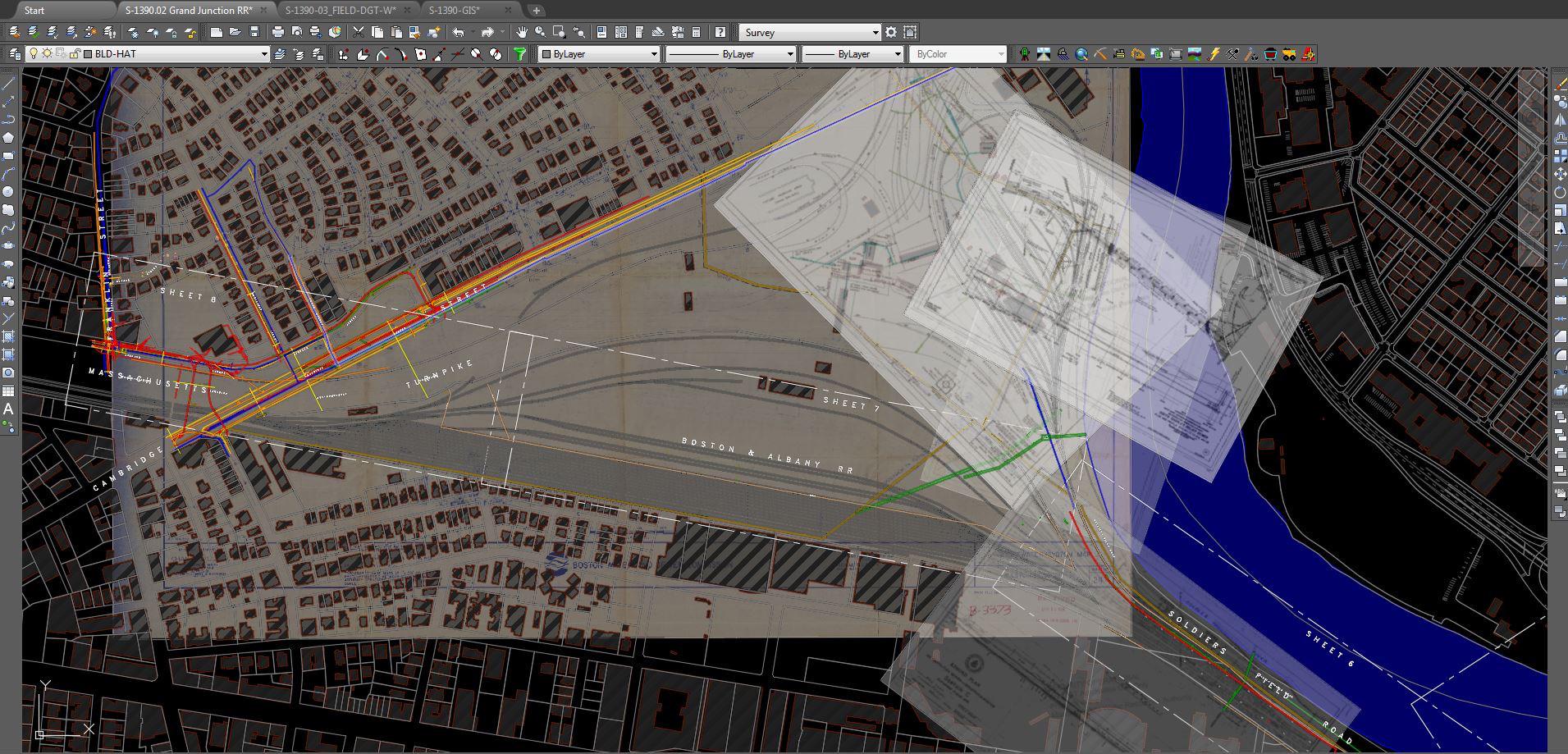
During the next phase of the project, surveying efforts began by utilizing photogrammetry to capture a large-scale aerial photo of the potential routes scouted by Eversource. This high-level view of the streets allowed for quick visibility of significant obstacles, ongoing construction, buildings, street renovations, and other significant planimetric details. DGT then established ground survey control to establish control networks throughout the streets that were being considered for the final design. Attention then shifted to collecting legacy data from both public and private sources, including GIS information from the city of Cambridge, Boston Water and Sewer, National Grid, and many other asset owners. In total, DGT collected over 10,000 underground files and compiled and presented the records in a single uniform composite utility plan in CAD format to Eversource’s design teams. These files provided Eversource with the information needed to eliminate some routes and narrow in on the more practical ones, helping Eversource make informed decisions early on in the project.

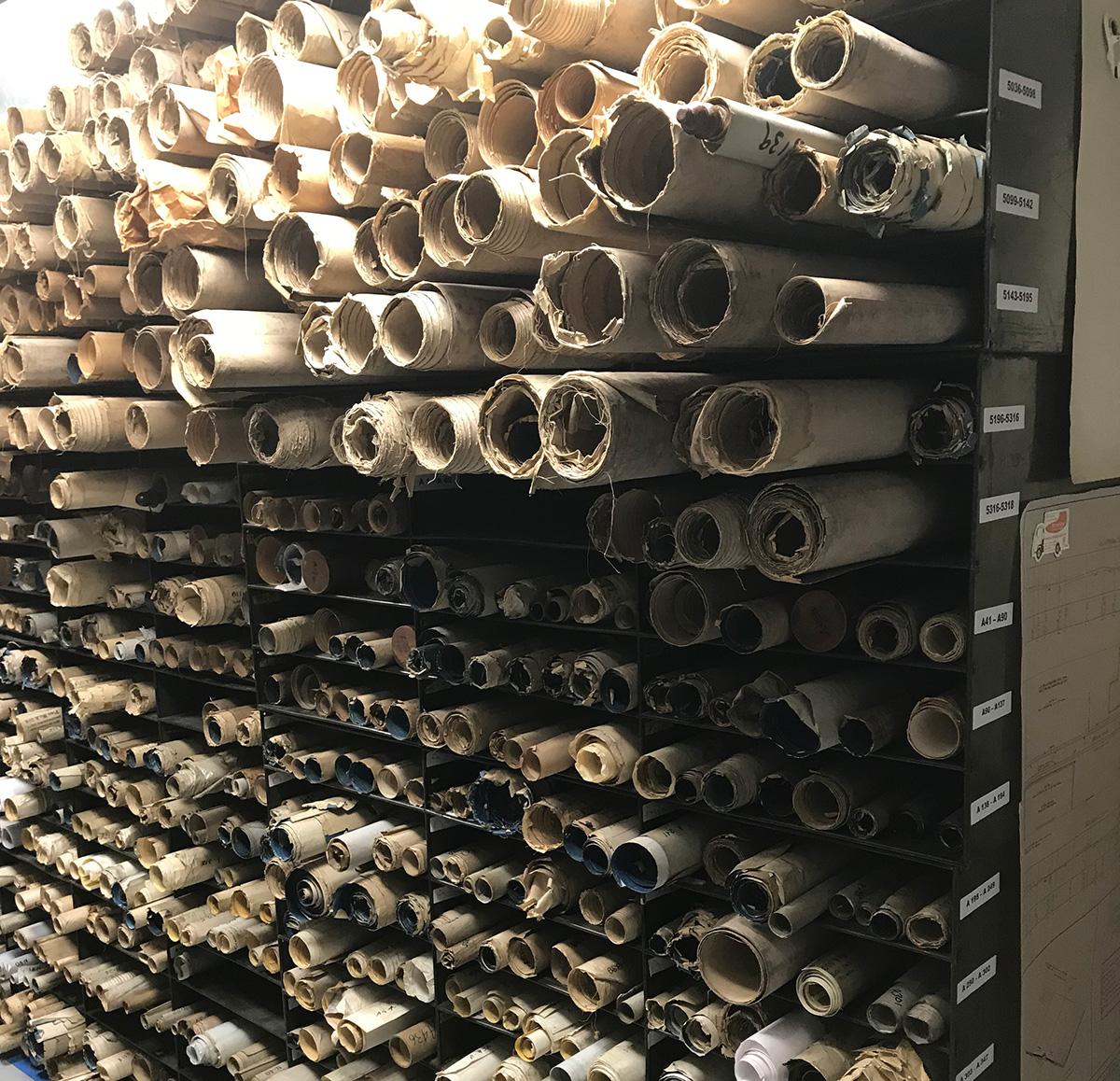
Plans in a nice stack at City Of Cambridge

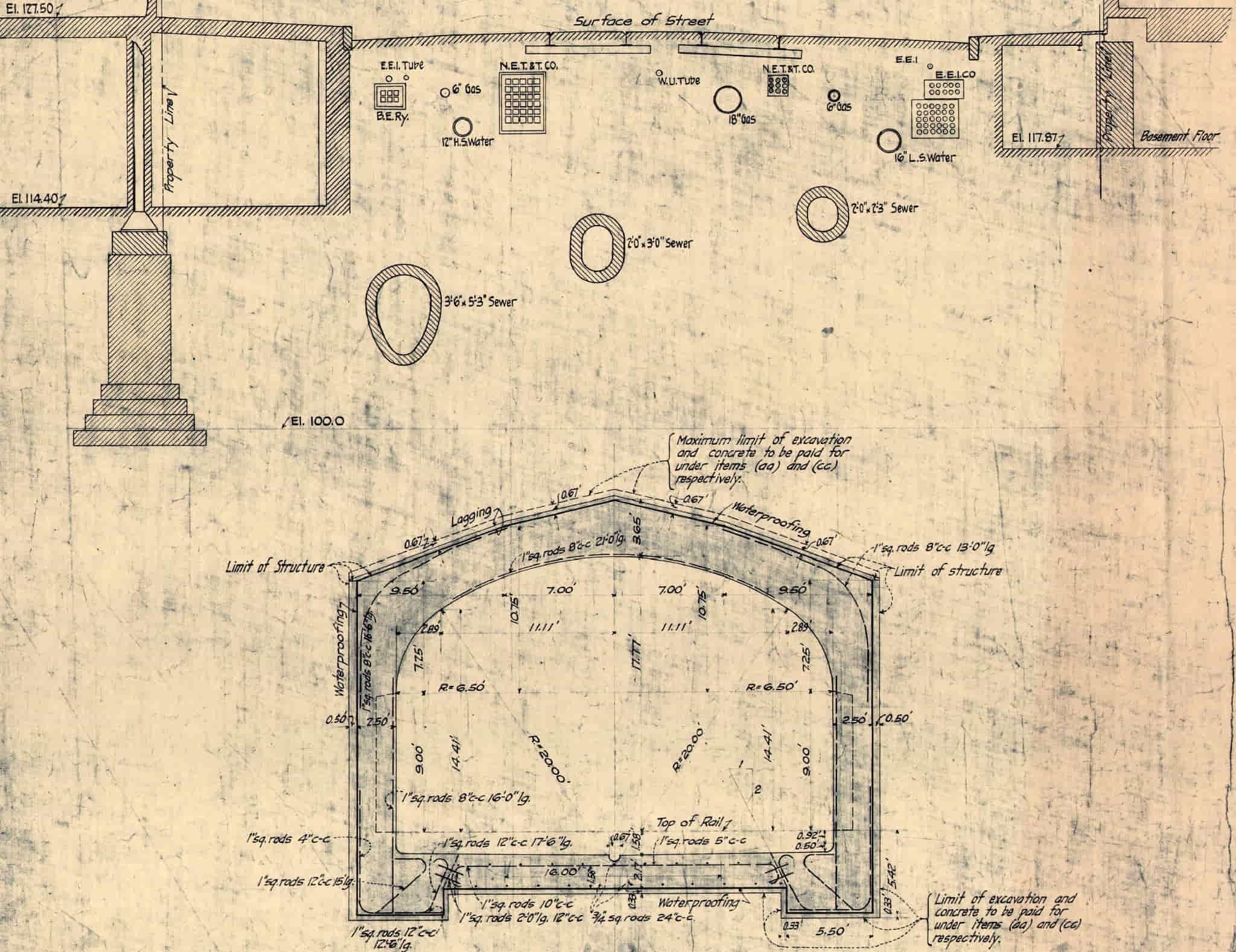
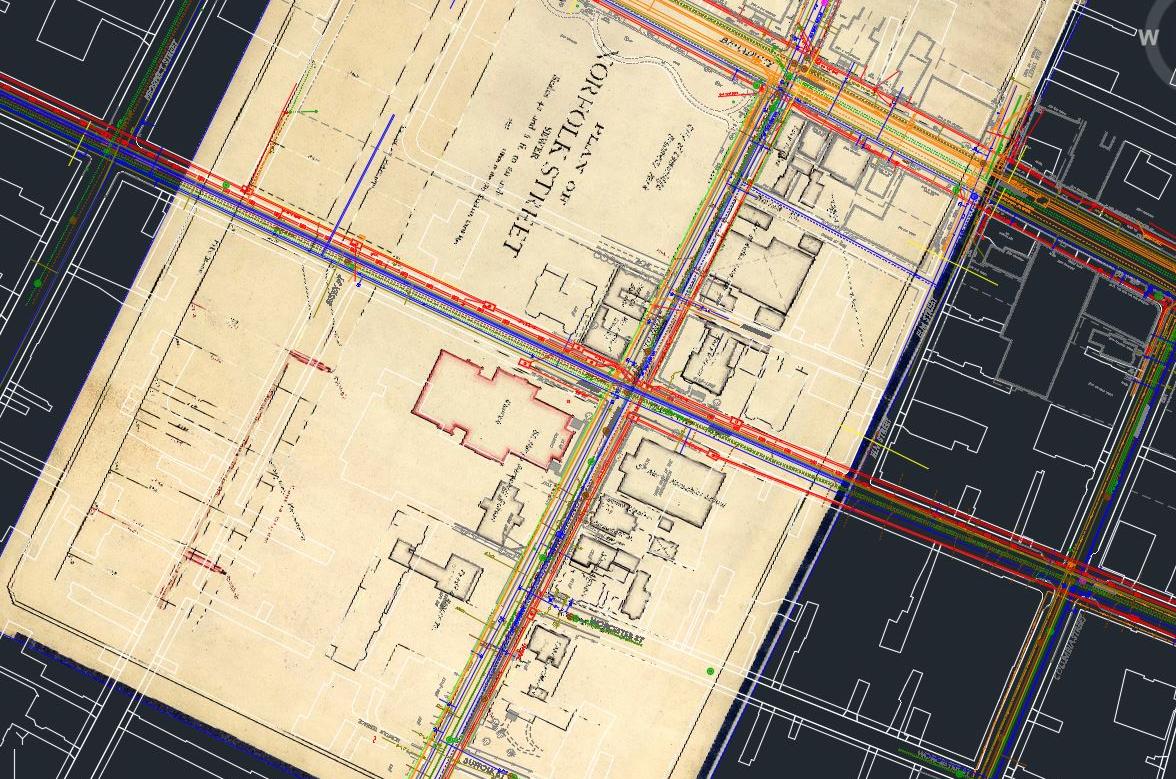
Massachusetts transit Authority plan that is 100 years old

Xray files for sum
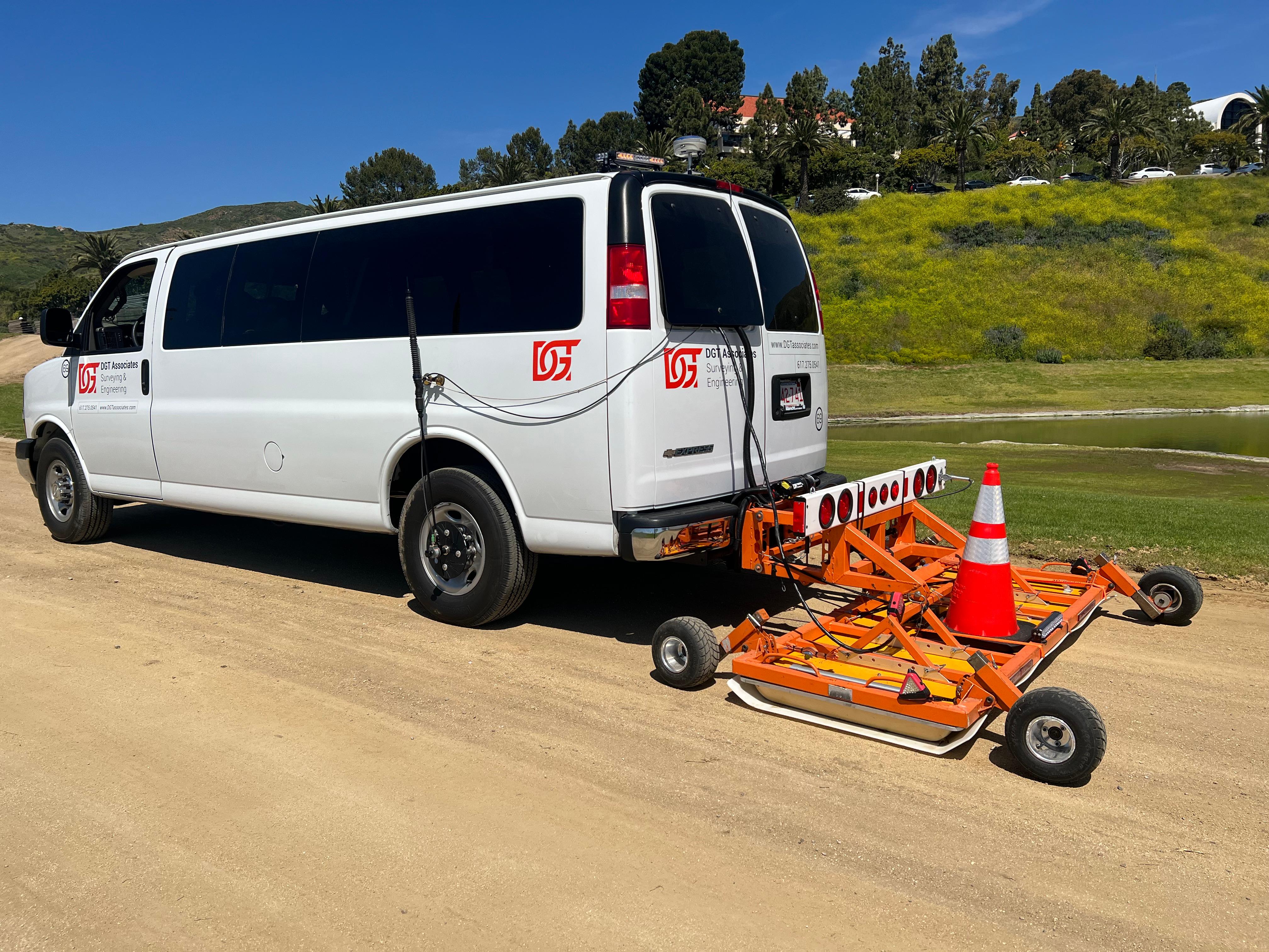
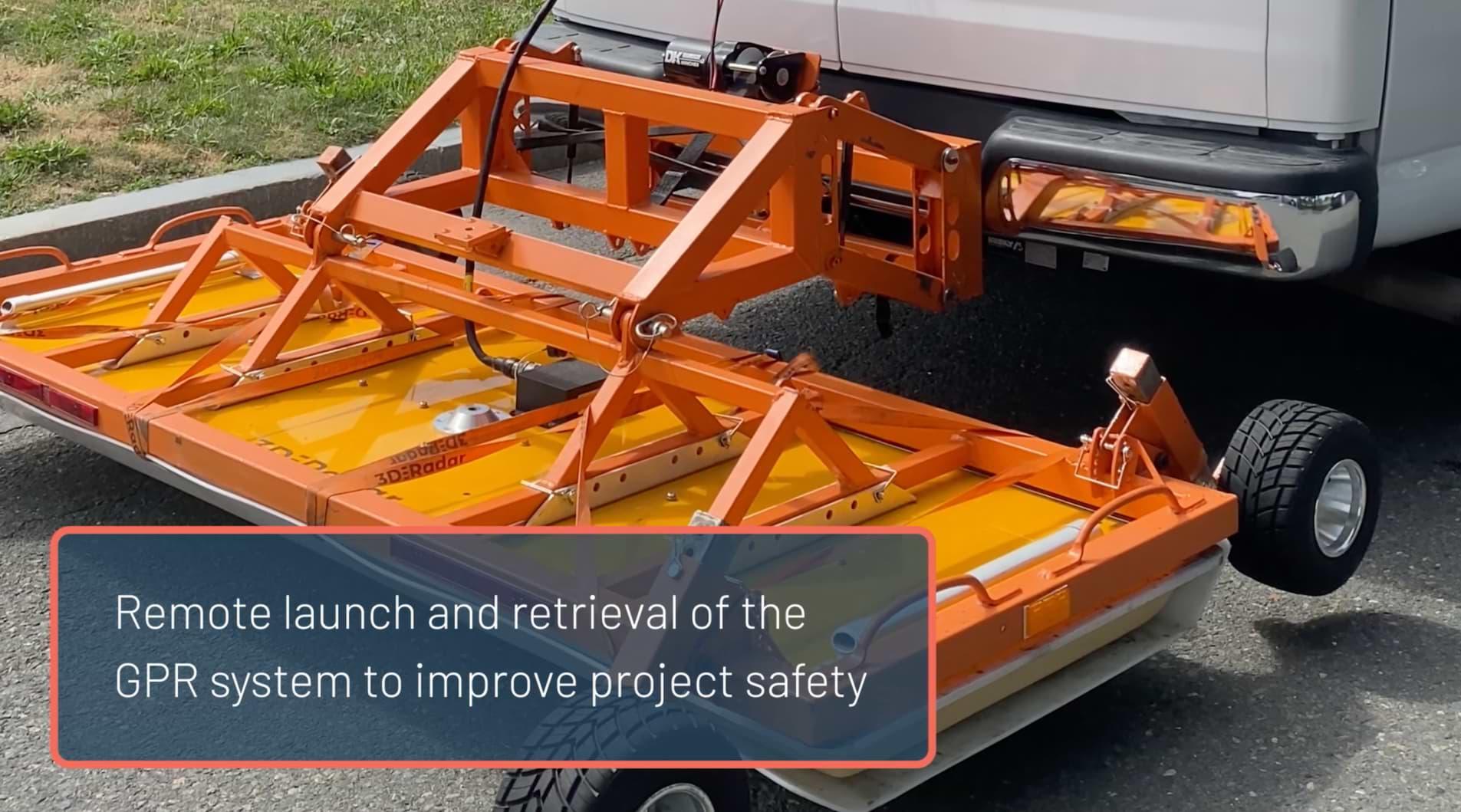
Eversource then handed the surveying data over to a third-party design firm that specializes in energy project engineering design. The firms got to work analyzing the most feasible routes for the power line alignments. Five routes were then selected and shared with DGT so that another round of surveying at a higher quality level could be performed. Capturing CI/ASCE 38-22 Quality Level B data, compared to Quality Level C and D, is much more time-consuming and requires intensive investigations. Additionally, the staffing and technologies required to conduct such an investigation are also more laborious. DGT set out to locate and map the five final routes in a choreographed fashion with multiple crews using handheld EMI equipment, pushcart Ground Penetrating Radar (GPR) systems, and survey locating. The results were all represented in comprehensive utility maps.

City sq DGT

DGT Deliverables can be in 2D or 3D. Abandoned systems are included
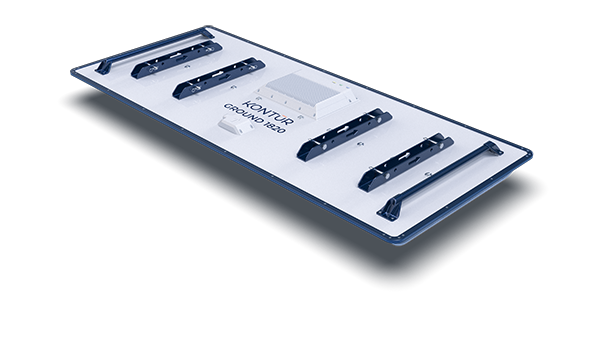
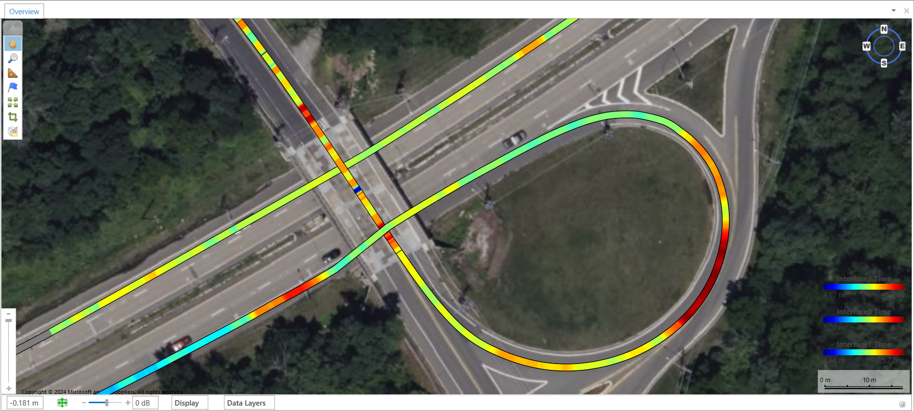
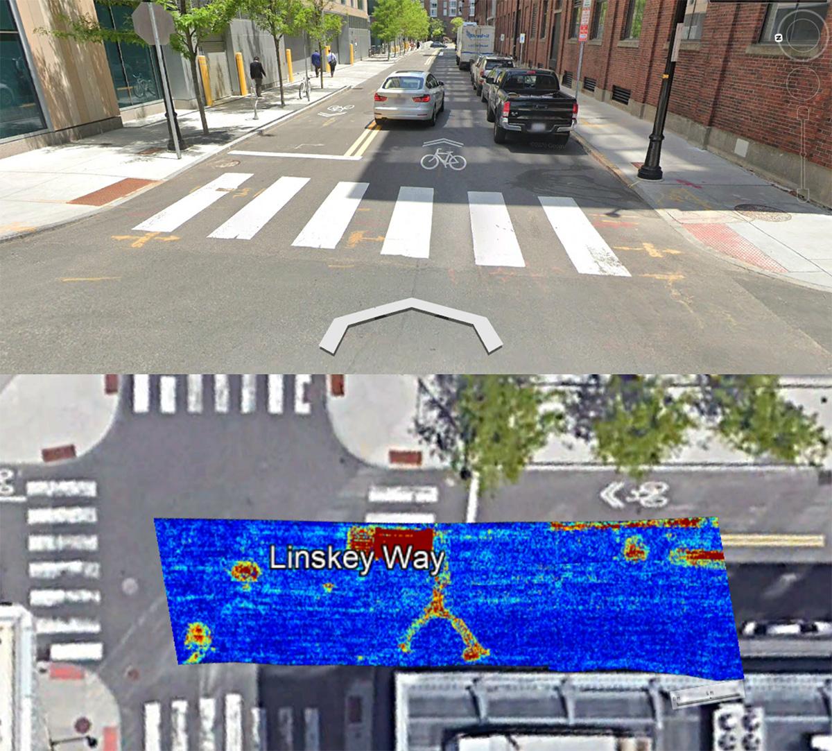
One of the key components to DGT’s success in these types of major projects is the verification of traditional utility locating using a unique wide-array, multi-frequency-high-speed data acquisition ground penetrating radar (GPR) system. The Kontur 2.1-meter antenna was specifically chosen for this effort after testing other systems in this unique urban environment. This program, often referred to as radar tomography, provides an extra level of care and detail in the plans, chasing perfection. While it’s much easier to trace the active facilities shown on the asset owners’ underground drawings, many of the project’s routes have a history dating back over 200 years, and these old streets don’t give up their secrets easily.


The wide array from Kontur GPR gave DGT the depth of detail not normally found in utility maps. Buried vaults, undocumented tunnels, abandoned systems, unrecorded new telecommunication networks, and layers of history are often exposed and included in DGT submissions. While these anomalies may not seem extremely important, these details are often contributing factors that trigger project delays, project claims, and escalating project costs. Uncovering as many surprises as possible for the design team allows designs to include more clear and concise information in construction documents. Upon completing the CI/ASCE 38-22 Quality Level B survey, which included radar tomography, DGT presented the findings to the design firm for a more detailed analysis. The final deliverables included much more than a comprehensive two and 3D position of underground utilities, but subways, underground tunnels, utility vaults, abandoned facilities, bridge approach slabs, underground tanks, and buried tram tracks were all documented in the final deliverables for the designer’s analysis and consideration.
Today, as the final stage of the project, we’re in the process of completing CI/ASCE 38-22 Quality Level A surveying for the top five chosen routes. This is the highest quality of underground data, which uses vacuum excavation to locate and map subsurface utilities precisely along the project’s path and mitigate conflicts arising from unmapped underground structures during the design phase. For this project, DGT will have completed thousands of vacuum test holes and trenches to obtain precise underground measurements and uncover potential utility conflicts. Upon completion, which is projected to be at the end of summer 2025, it will be up to the design firm to follow the appropriate channels to receive the stamp of approval on a major infrastructure project of this size. This will consist of talking to all the affected underground asset owners, university officials, city officials, and other community stakeholders that the added transmission routes will impact. It will likely take the design firm a full calendar year to analyze the entirety of our mapping deliverables, but construction will be phased as the final route design, selection, and permitting is complete. Once the team selects the final route and receives approval from city officials, the last stage of the project will be constructing the new transmission routes. While we know this will likely take years to complete, we are hopeful that we will be brought in once more by Eversource to do a round of as-built updates to the subsurface utility mapping that has been generated. The result will be a more robust electrical grid in one of the great US cities. Over the past 200 years, some of the oldest US infrastructure has been continuously growing, and documenting the underground challenges to the design, planning, and constructors will be paramount to the project's success. DGT is proud to be part of an intricate project that improves the lives of Bostonians and allows for continued safe and reliable access to the electric grid.

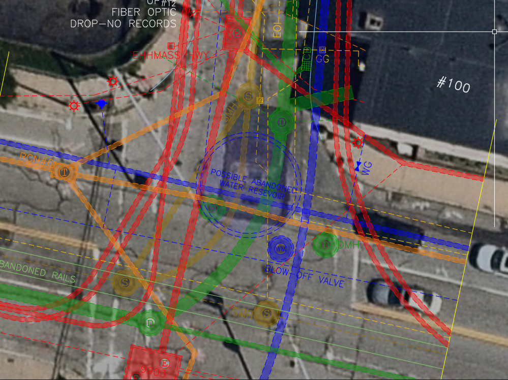
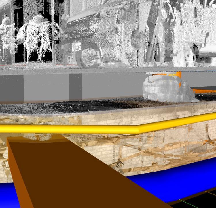
Abandoned Buried Water Reservoir may be still in the street, Radar finds these old systems

DGT Above and Below ground mapping; Not BIM SIM Subsurface Information Mapping

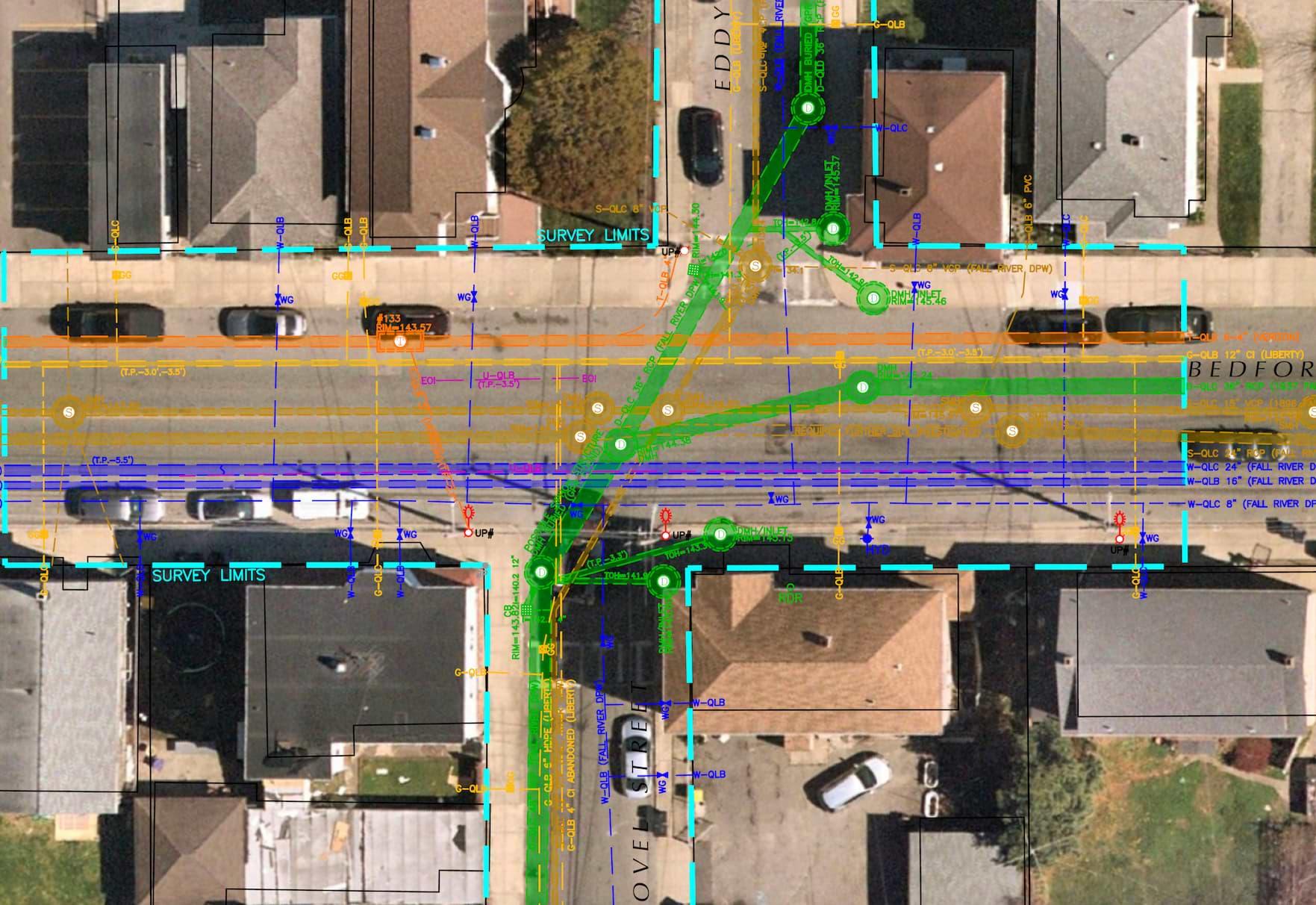
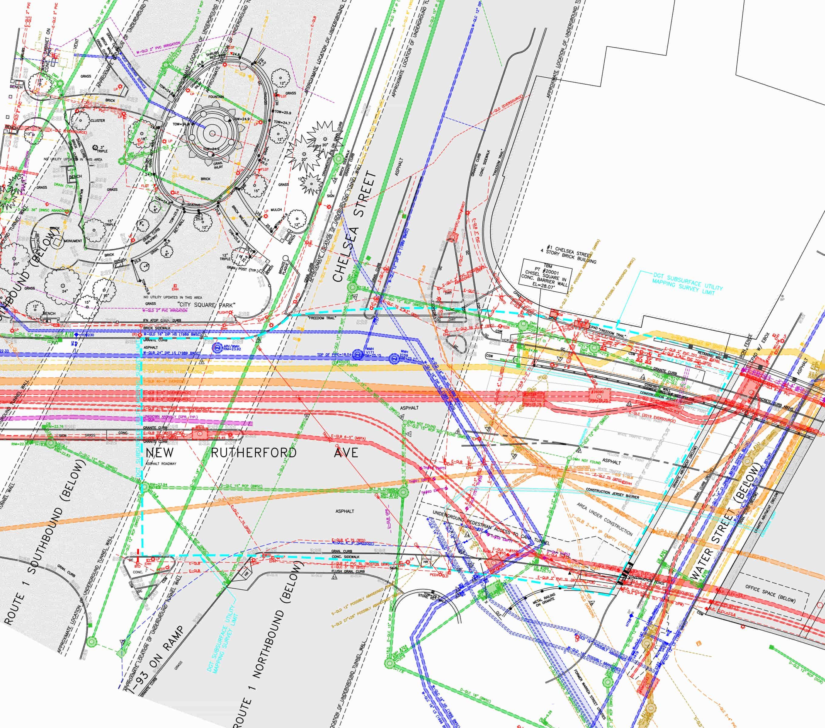
DGT sample of a High-definition plan for Infrastructure renewal and replacement


Radar Tomography