Efficient road maintenance requires accurate data and a deep understanding of the surface and the layers beneath it. By combining Mobile Mapping technology with Ground-Penetrating Radar (GPR), road authorities and contractors can optimize inspection, analysis, and maintenance planning.
GPR and Mobile Mapping
3D Digital Twin – Above and Below Ground
Optimized Road Maintenance
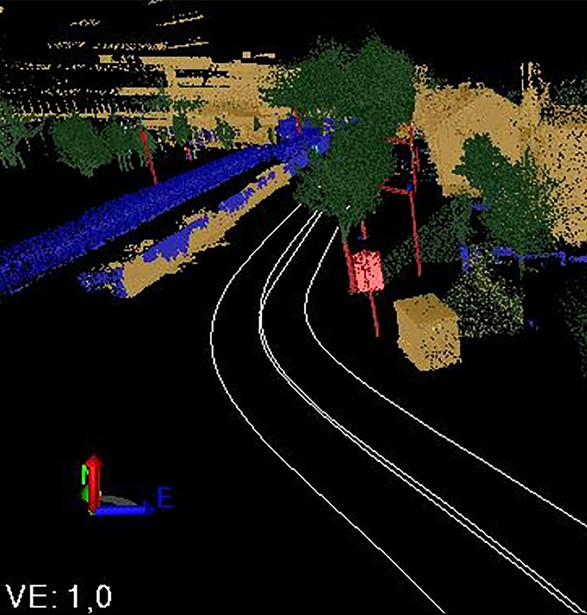
Precision Above Ground Mapping
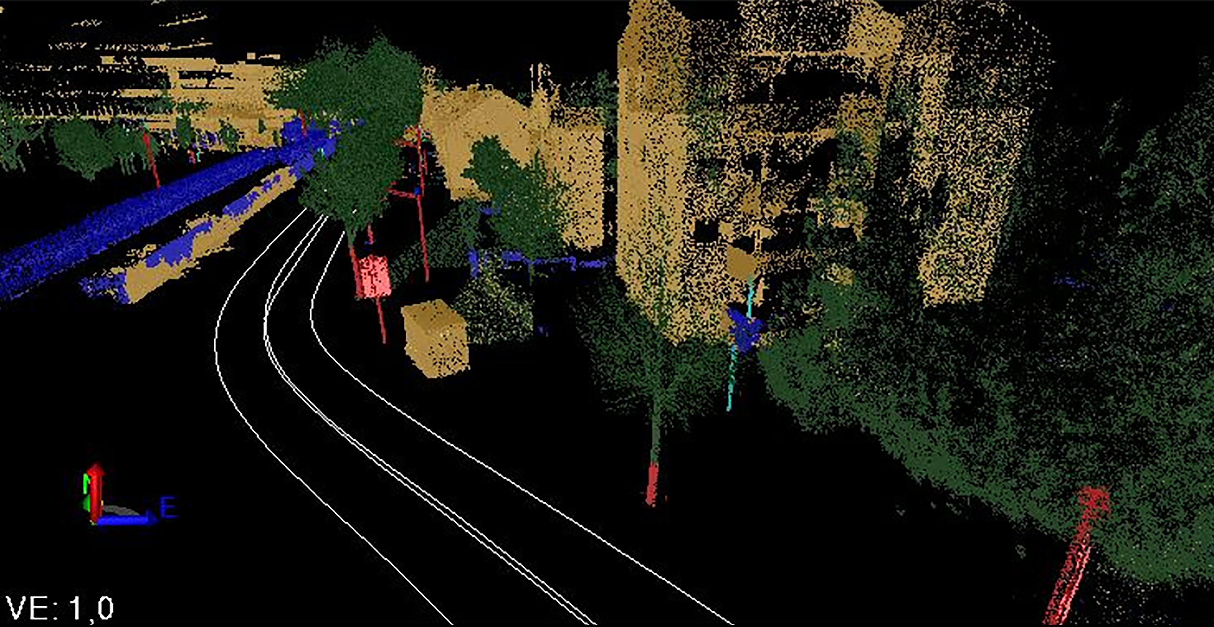
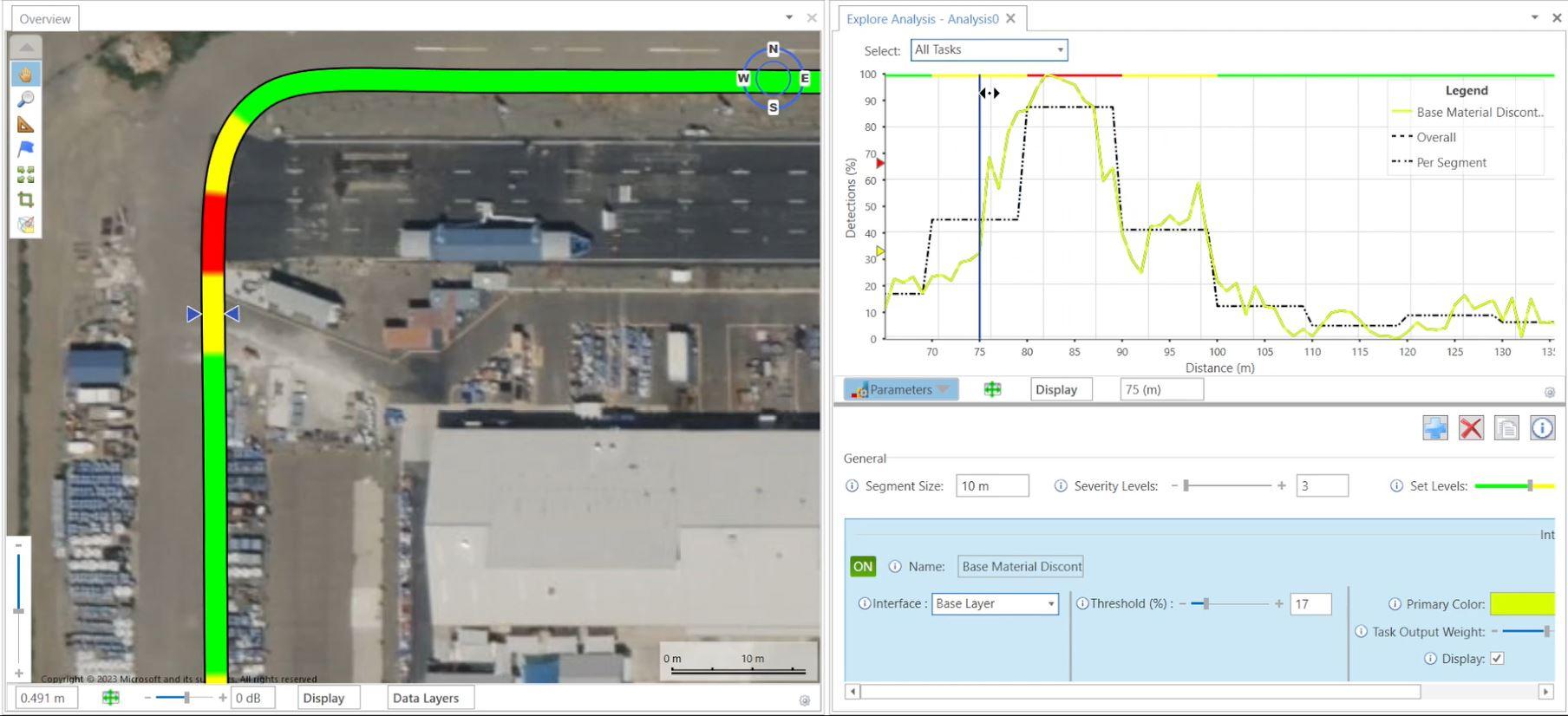
Mobile Mapping enables the rapid collection of geospatial data using LiDAR and high-resolution imagery – all from a moving vehicle. This technology provides a detailed overview of road conditions, identifying cracks, wear, and deformations while streamlining decision-making for maintenance actions.
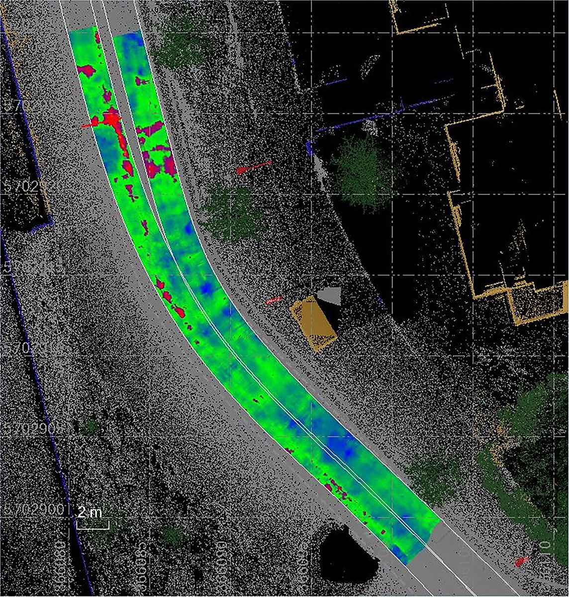
Subsurface Insights with GPR
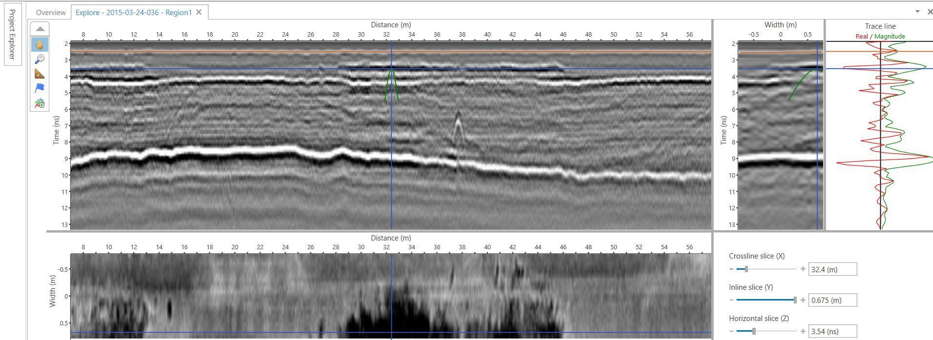
While Mobile Mapping delivers precise surface mapping, GPR reveals critical information about the underlying road structure. GPR detects layer compositions, voids, water infiltration, and other hidden issues that can lead to pavement deterioration by transmitting electromagnetic signals into the ground.

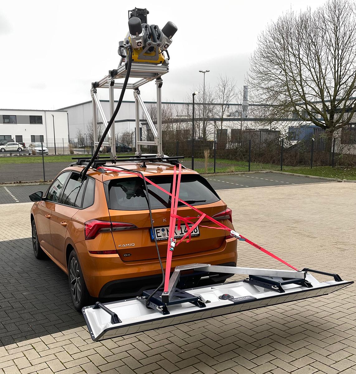
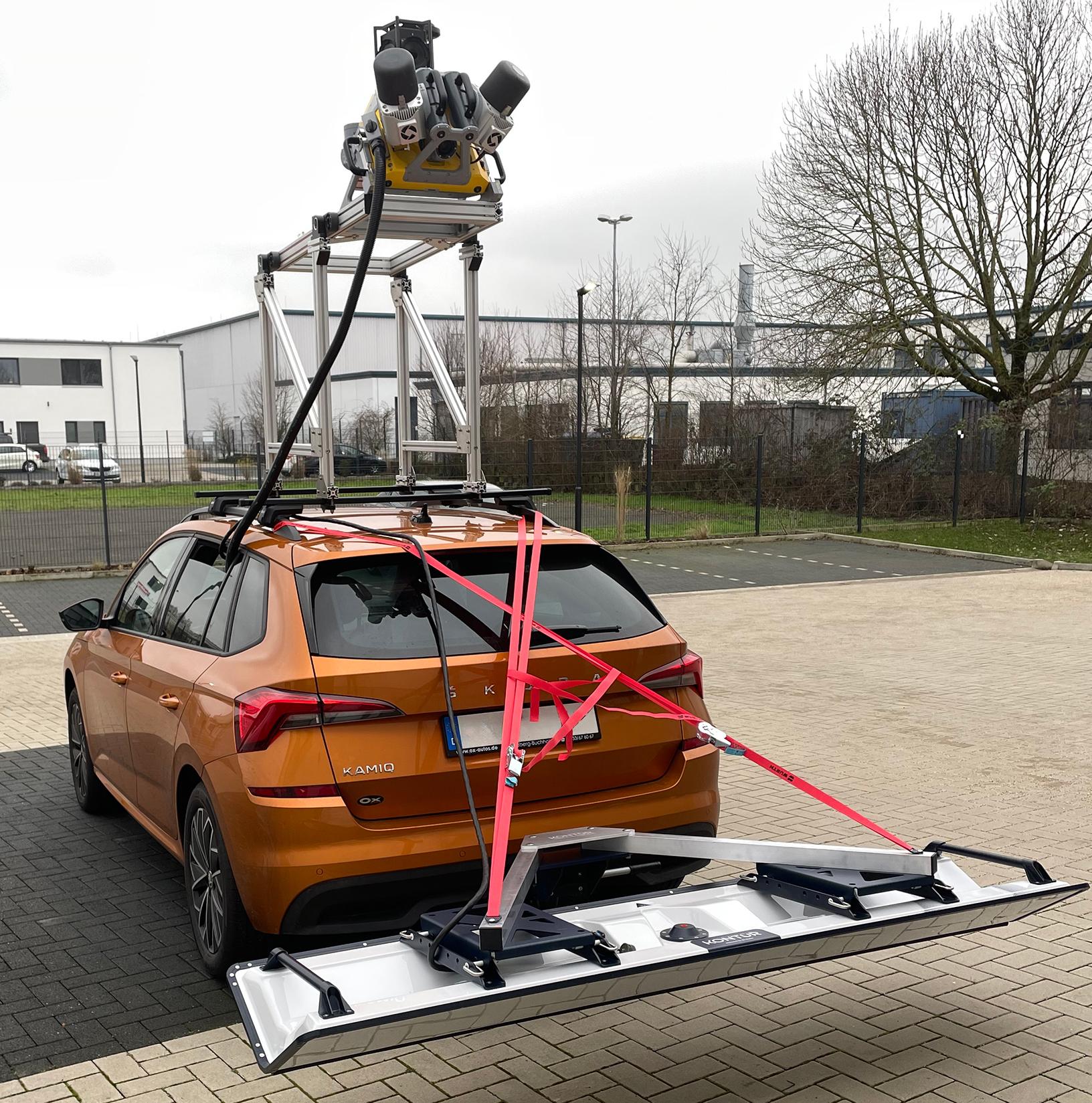
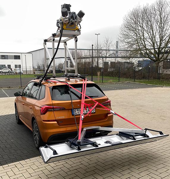
Car with a Mobile Mapping System and a GPR AIR Sensor

Above Ground

Subsurface
Key Benefits of the combination:
By integrating data from both technologies, road maintenance projects become more proactive and cost-effective:
- Early Damage Detection: Identify structural weaknesses before they escalate into costly repairs.
- Accurate Maintenance Planning: Reduce the need for expensive emergency interventions by basing maintenance strategies on comprehensive data.
- Efficient Resource Allocation: Prioritize repairs based on data-driven insights to extend road lifespan and minimize costs.
The combination of Mobile Mapping and GPR provides a holistic understanding of road conditions, enabling smarter and more sustainable maintenance solutions. This ensures safer and more reliable roads for the future.
High-Speed, High-Resolution Road Insights
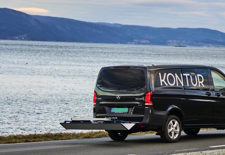
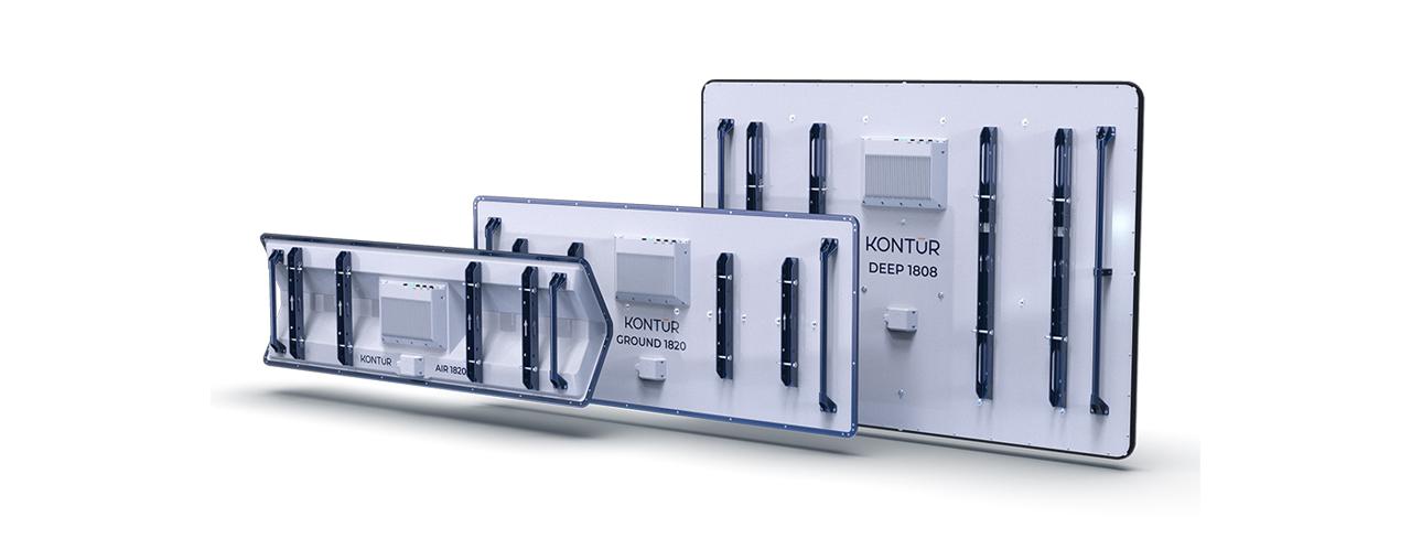
The Kontur GPR system is the perfect complement to Mobile Mapping, thanks to its Step-Frequency 3D technology and ability to capture vast amounts of subsurface data at full traffic speed. This advanced system delivers:
- Unmatched Data Density – High-resolution, 3D imaging of road layers for precise analysis.
- Seamless High-Speed Operation – Collects detailed subsurface data without disrupting traffic.
- Comprehensive Road Insights – Simultaneous surface and subsurface mapping for proactive maintenance.
By integrating Kontur GPR with Mobile Mapping, road authorities and contractors gain a faster, more efficient, and data-driven approach to infrastructure management—minimizing costs, extending road lifespan, and ensuring safer travel.